

On Thursday morning in May
two guys got up early, piled into a pickup and headed south out of Aztec.
That same Thursday morning
I met my friend the minister and we headed west from Bernalillo for a day spent
in spiritual communion with one of our geologic neighbors known as Cabezón; Big
Head.
 |
| Cabezon Peak |
Cabezón is about one and a
half hours northwest of Albuquerque
 |
| Perfect spring weather! |
 |
| Heading up the trail with the minister. |
 |
| Lichen the shade! |
 |
| Pink Desert flower. |
 |
| See the signal fire on that peak to the south? |
On all sides but one we could see for hundreds of miles. Cabezón is the tallest formation of its kind, but by no means the only one and it was impossible not to imagine these highly defensible positions being used to communicate along the length of the Rio Puerco in some pre-Columbian period.
Wikipedia’s brief entry
starts with “Cabezón Peak is a large volcanic plug….” This entire region is part of the same Mt.
Taylor volcanic field that produced
the Malpaís near Grants, NM and Inscription Rock and the Bandera Ice
Caves
While I was standing on
the side of the peak gazing at the other plugs and calderas so far away I also
became aware of how small I was in the vastness of the desert. I began to regard the thin, winding trail of
the Rio Puerco, identifiable because of the trees and dense brush that ran it’s
– how to say this – non-desiccated length, as the preferred highway for travel
through the region. Where there was
water and shade there would surely be the best options for sustenance available.
 |
| If you squint closely you can see a fence line from above HERE in this caption all the way to the small peak just right of "up center." |
As we continued our hike,
slowly exhaling the last of the city air and becoming accustomed to the dry
air, thankful for the steady breeze out of the west and glad we had plenty of
water we were winding our way to the southeast corner where we came to a fork
in the road.
One fork led directly
northwest and up the side of the peak, zigzagging in tight slalom turns up the
scree. This was the path that clearly
was used with great frequency.
The other path continued along
the base of the scree now beginning to head toward the northeast, clearly not as popular a path.
The direct path up the
scree looked decidedly less inviting than the path that continued forward and
my friend the minister and I, being essentially brave in some respects and
unwilling to climb straight up the scree in other respects, took the path less traveled Plus, we both believe in
exploring the bounds of our communion when at church service.
We continued on for approximately
another three quarters of a mile before the trail forked again. Well, it didn't precisely fork so much as take
a turn down and away from the mountain. We forked.
We headed up into the scree now, without much of a trail at all.
 |
| Trail? We don' need no stinkin' trail! |
By now, of course, we’d
decided to consult the map left by the BLM.
Being the trailblazers we were scorned the map, using the distant
details on the horizon to orient ourselves on the side of the peak and to
determine the river winding below must be the Rio Puerco. We just wanted to confirm now, that we were
long past the correct ascent, our suspicions about being able to intercept the
correct ascent on our own
upward trajectory.
 |
| Stop and smell the verbena. |
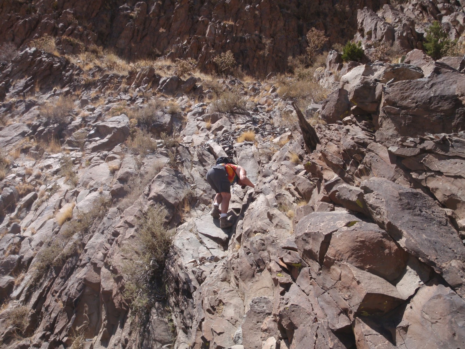
We started scrambling over
the scree, often practically on all fours due to how steep the pitch was, how
slippery the loose shale was and how often we were on the verge of falling
anyway. Now we were not talking much,
each of us concentrating on trailblazing.
 |
| Yeah, it was that steep. |
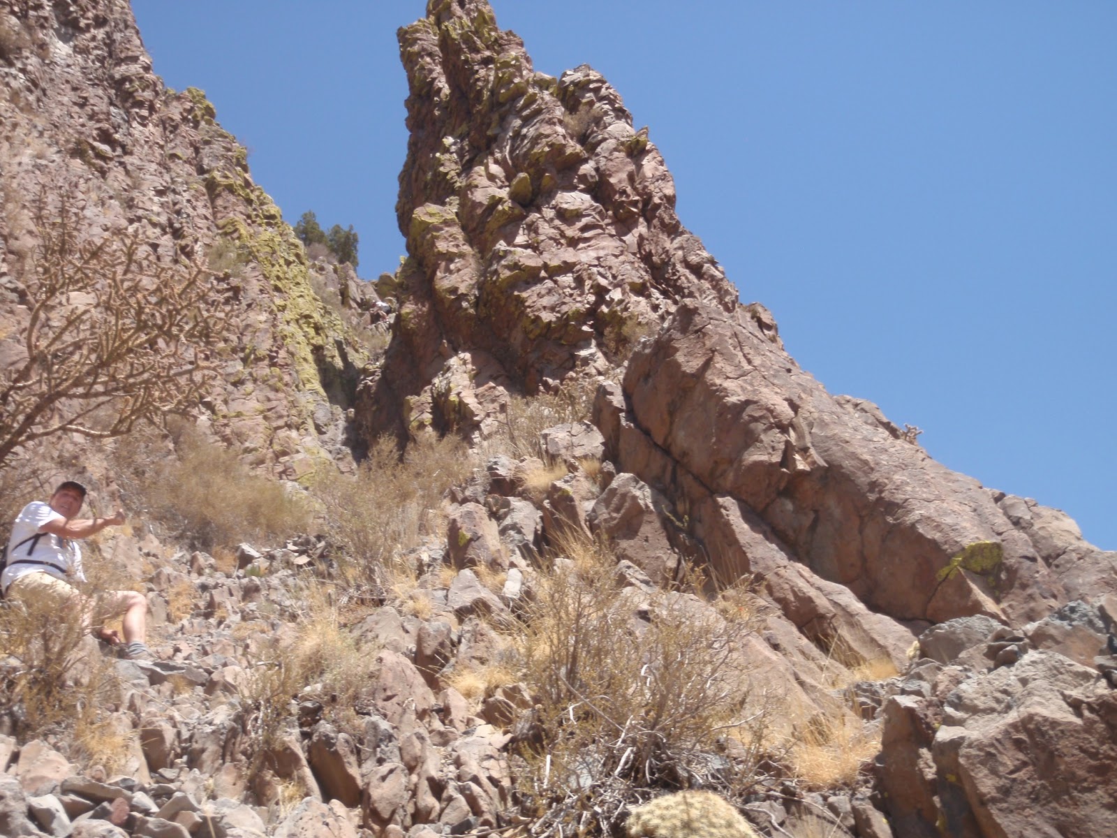
Of course, Cabezón Peak cairns
Up near the top of the
chimney we were reaching, after a couple of hours on the trail, were two
fellows coming down.
These were the two
names I’d seen in the entry log below and they were from Aztec. Cabezón is about two and a half hours south of
Aztec and here were these two guys coming
down! Calculating they’d hiked two and
a half hours and spent at least an hour on the top (about what we were to
spend) that means they were on the trail by about seven in the morning.
 |
| Mike points out our Aztec friends making their way down. |
Cabezón is about two and a
half hours south of Aztec and it left me wondering whether these guys were up
at 4:30 a.m. or if they’d stayed the night. Their packs were about twice as big as ours
and ours had one day’s water and some snacks so it was possible they’d added a
lightweight bivy-bag each and had heard the coyotes sing under the uncountable
stars.
The chimney was, according
to our Aztec friends, “class four bouldering,” big enough you might fall and
far enough off the ground you’d probably get hurt if you did.
 |
| Bouldering; very zen. |
 |
| Zen Boulder Master. |
Up close and personal was
happening NOW! With my whole body
hugging the side and my hands reaching out and caressing, touching and
exploring tenderly to find a hand-hold I was smelling the earth, dabbing with
my toes and intently focusing on my path upward.
Of course, I’m an old hand
at this sort of thing and was up in a couple of minutes, as was the minister,
whereupon we gave thanks. We watched as
our Aztec friends lowered their packs on a line before they headed down. Briefly it crossed my mind that we’d be
following them soon enough.
Once through the chimney
it’s a matter of moments to reach the crest where a small spiral formed of lava
stones contains the Cabezón entry log within an army ammo box, along with
emergency rations of water and Gatorade for those in need.
 |
| On top. |
We each penned a few brief
thoughts in the book and got our grub on while exploring the panoramic views,
the other two little shelters (they HAD to be lookout posts for the signalmen –
you go up there and tell me you don’t agree!) and looking for sign. There is clear evidence some big coyotes have
made there way to the top.
Of course, most of the
trip back was simply the reverse of the trip up with two notable exceptions; we
went straight down the scree trail when we reached it and we only reached it
after doing some downward class four bouldering!
If the climb was personal on the way up then
the level of trust I brought into my relationship on the way down – when I couldn't
see where my footholds were going to be – was surreal.
 |
| Lichen were everywhere. |
Baxter Black’s “Cowboy’s Prayer” refers to the beauty of god’s creation in a way that has always
expressed for me my own feelings of appreciation when I’m in the wild;
Oh Lord, I've never lived where churches grow.
I loved creation better as it stood
That day You finished it so long ago
And looked upon Your work and called it good.
I know that others find You in the light
That's sifted down through tinted window panes,
And yet I seem to feel You near tonight
In this dim, quiet starlight on the plains.Sometimes the minister and I will paddle up the Rio Grande to visit Painted Cave in the Bandelier Forest, sometimes we’ll ski between the trees on a stormy day, and sometimes we’ll just go for a bike ride.
And most always it’s a spiritual experience in the Church of the Blue Sky.